22 Feb

Flooding Maps

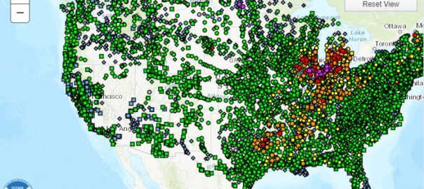
In today’s blog article, I just wanted to share a useful resource that the National Weather Service provides.  It’s an interactive flooding maps tool that will allow you to see where in the United States is currently at risk of Major, Moderate, and minor flood events.

Using these flooding maps is a great way to assess your risk of a flood event damaging your home and property.  Because these are updated regularly, you can see how the flooding risk will change throughout the year and in different areas of the country.

To view the flooding maps page, visit the National Oceanic and Atmospheric Administration’s (NOAA) National Weather Service website using this link.

Additionally, if you’re curious about if your home is in or near a high risk flood zone, you can use the FEMA flooding maps tool at this link.  This map has a lot of data and can let you know if your home is within the boundries of a high risk flood zone (varations marked by the letter “A”) or a low to moderate risk zone (known as X zones).   If your home is in a special flood hazard area (SFHA)  your lender will more than likely require that you have purchased flood insurance as condition of your mortgage.


To visit the FEMA National Flood Insurance Program’s mapping system, you can click here.  

Once you’ve reached the FEMA GeoPlatform hub, select flooding,  Once you’ve done this, click the link to the FEMA National Flood Hazard Official Layer as shown in the picture below. Finally,  type your property’s address into the search bar in the upper right hand corner of the map and the system will allow you to see where your home’s location resides in conjunction with the flooding maps.   This is a valuable tool to give you an idea if a home you’re looking to purchase may require flood insurance in order to fund your loan.

21 Nov

What is a Flood Zone?

Flood Zone - what is a Flood zone?

In the world of flood insurance, the most important factor in rating a particular property is determining the flood zone the property resides in.  Now, it’s important to remember that every property is in a flood zone, and flooding can happen literally anywhere!  Your home may sit on a hill or an elevated position, but it still can potentially be susceptible to a flooding event.

Understanding what a flood zone is

Flood zone maps were introduced by FEMA and are known as Flood Insurance Rate Maps (FIRMs).  These maps show the relative risk a property has when calculating for the proximity to different low lying or water containing areas.  The flood zones are broken into several categories.

Flood hazard areas identified on the Flood Insurance Rate Map are identified as a Special Flood Hazard Area (SFHA). SFHA are defined as the area that will be inundated by the flood event having a 1-percent chance of being equaled or exceeded in any given year. The 1-percent annual chance flood is also referred to as the base flood or 100-year flood. SFHAs are labeled as Zone A, Zone AO, Zone AH, Zones A1-A30, Zone AE, Zone A99, Zone AR, Zone AR/AE, Zone AR/AO, Zone AR/A1-A30, Zone AR/A, Zone V, Zone VE, and Zones V1-V30. Moderate flood hazard areas, labeled Zone B or Zone X (shaded) are also shown on the FIRM, and are the areas between the limits of the base flood and the 0.2-percent-annual-chance (or 500-year) flood. The areas of minimal flood hazard, which are the areas outside the SFHA and higher than the elevation of the 0.2-percent-annual-chance flood, are labeled Zone C or Zone X (unshaded).  Read more here on the FEMA website.

Want to check to see if you’re in a flood zone?  Use the FEMA National Flood Hazard Map layer and type in your address. 

Basically, you can break down a flood zone into two basic categories:

High flood risk areas

These areas area in what is commonly referred to as residing in a “100 year flood zone” and has at least a 1% annual chance of flooding.   That equates to a 26% chance the property will flood over the life of a 30 year mortgage!  Homeowners that have a federally insured mortgage that live in these areas will be required by law to carry flood insurance.   On flood zone maps, these will be labeled as an “A”  or “V” zone.

Moderate & low flood risk areas

These areas still run the risk of flooding, but it is much lesser than those that reside in a high risk area.  On flood zone maps, they are labeled with the letters B, X or C .  While property owners in these low to moderate risk areas aren’t required to carry flood insurance, it is still recommended as a regular homeowner’s insurance policy does not cover the peril of flooding.

Obtaining Flood Zone Insurance

Save Flood Insurance agency Inc offers a private market alternative to the NFIP policies offered by the Federal government.  If you would like to get a quote for flood insurance, please fill out the form below.